InSAR results
Results from InSAR data analysis
The dynamic interplay between rifting and magmatism in the Kivu Rift region has resulted in significant geological deformation. This intricate relationship is shown in several deformation features, including seismic activity, the eruptions of active volcanoes like Nyiragongo (2021) and Nyamuragira (2023), and transient ground movement around the rift system both during and outside of eruptive periods. Leveraging time series analysis of InSAR, we aim to gain detailed insights into these ongoing processes and to unravel the intricate connection between short-term deformation signals and long-term geological processes within the region.
Our research involves conducting a comprehensive time series analysis using GNSS data collected from a network established in Rwanda in August 2022, in conjunction with available InSAR data. Through this analysis, we endeavor to enhance our understanding of the region’s deformation cycles, particularly before and after the May 2021 Nyiragongo eruption.
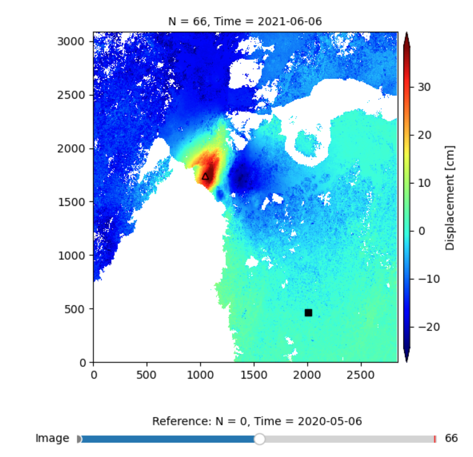
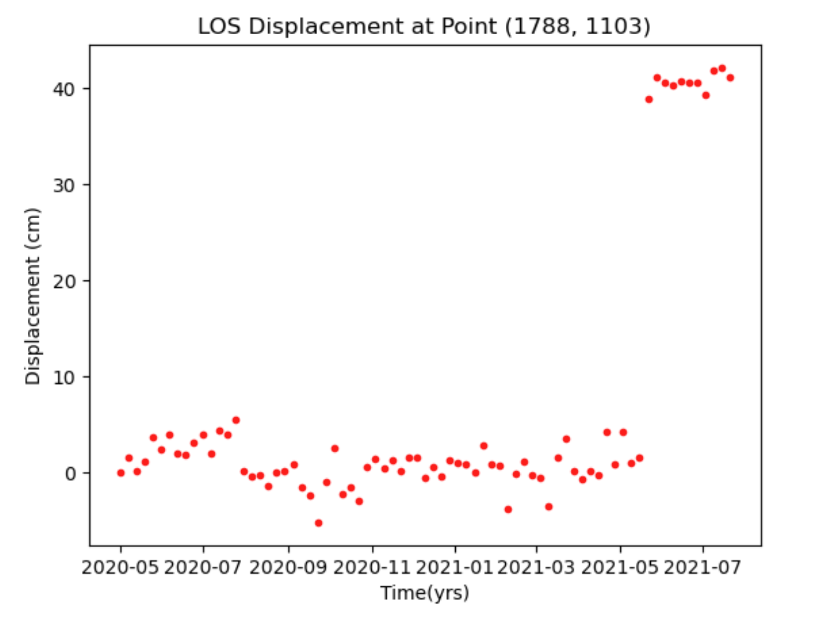
Below are some of the early results from our InSAR time series analysis covering a year before and after the May 2021 Nyiragongo eruption.
Map of deformation around Kivu during 2021 eruption and rifting event


